Saturday, May 2, 2015

Great Basin Traverse: To Tonopah


4/30-5/2
~89.5m

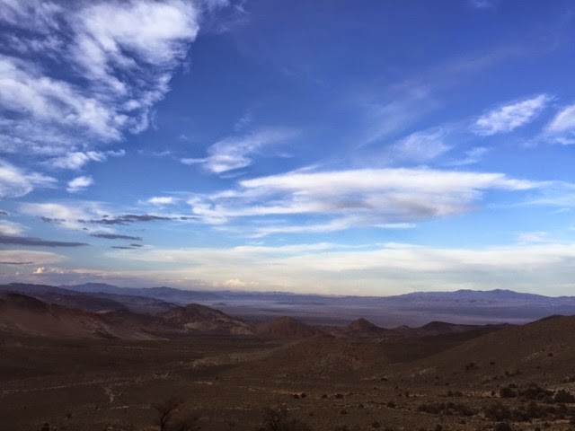
Within 2m of Willow Spring I passed an innocuous orange carsonite post and crossed into Nevada. The Great Basin Traverse now began. I followed the Desert Trail maps to guide me through the Sylvania Mountains. Mining dominated the range, however, Steve Tabor, author of the guidebooks, found a cross country route through the range using drainages to tie the highest peaks together. From thick Joshua tree groves to pinyon pine and juniper, the 8,000ft range showcased a fecundity not seen from the basins and valleys below. From a few thousand feet lower the trees looked like tiny black dots.


At Magruder Spring, I tallied up my food. After some mileage calculations I figured I was a good day and a half short in food. I had to make a decision. Do I take a cut off and bust out some high mileage to end the section in a less scenic way? Or do I hitch all the way to Tonopah, gather some supplies, and hike the Silver Peak Range and make the Great Basin Traverse a more quality drive route? I decided on the latter. But hitching to Tonopah on a rural desert highway straddling two states proved to be way more difficult than I expected. This hitch gave me the perspective I needed: I am in the middle of fucking nowhere.

And that's exactly what I wanted in this route.


After 3 hitches, including the last one into Tonopah with an old showgirl/pot grower/chiropractor/gold miner from Alaska/Sierra Vista/Yuma/Las Vegas in a gutted out Ford Astrovan with a dog named Taco Bell, I finally ambled into Tonopah. I tell you, that was the only hitch I've had where I felt really uncomfortable. But I truly needed the ride. So, after re-grouping, assessing my needs and the hitching situation I decided to trek southbound and reconnect from where I initially hitched from. I figured that way I could get back on the route way sooner.


There's much of this route that is 'on the fly,' or adapting to what is in front of me as it happens. I under-stocked myself with food due to emotions running high with recent personal events, a tad disorganized with the route because of personal events, and the Death Valley route taking a little bit longer than expected. I would like to hope I learned from this mistake, nevertheless, flexibility and being able to be resourceful and adaptable are of my biggest concern.


I left Tonopah relatively early and legged out a 35m day. Of note, I had another 40m waterless stretch. Despite the lack of water, leaving from Tonopah helped me out. Trekking through Paymaster Canyon under Lone Mountain and the Weepah Hills turned into a pleasant surprise. The colors of rock represented a palette of incredibly interesting shades of reds and blues. Then, after the canyon, I entered the expanse of an alkali lake bed. The various types of soils and dirt struck me as astonishing. The squishy type, the hard cemented sort, the fluffy, the dusty, the rocky, you name I crossed it. The occasional sand dune buffeted the arid-loving plants. Bristly and thistle-like, the shrubs clung to life in a moonscape. Most of the landscape was shaped by water but the wind left its unmistakable mark. Some shrubs' roots held the caked dirt in a piled up casing, as the windswept sand left a circular furrow around the shrub. I had seen the Devil's Cornfield in Death Valley, so with the similar shapes that these shrubs made I dubbed the round, big clumps Devil's Haystacks.


Unbeknownst to me, Silverpeak is a mining town still populated by miners who work in a Lithium Plant. The mine seemed relatively new and because of that the town still shown its old ghost town appearance. No new buildings, except portable trailers, nor businesses, just old junk, a boom town starting back up again. The stench of hot springs sunk the air and metal scrap yards littered the fields and lots. I camped on a barren ridge line anxious to get to the mountains.

Up early the next morning as the miners and their beefy Ford trucks lumbered up the newly graded road. I pushed hard to get out of the unsuspecting traffic. The good thing was that I found 3 springs, the last of which came out of a giant cave. From there I went up Argentite Canyon with purple basalt rock formations peppered with green and orange lichen. A few old miner's cabins, a tagging of Piper Peak, and I flew down to Big Spring, where I sat beneath a large sagebrush and had a five minute staring contest with a young jackrabbit. He couldn't quite gather what I was as he nibbled the green grass near the rivulet. He even stood on his hind legs to observe me more, his nose wriggling constantly. 


I left the spring fat with water. Up into the Oasis Divide via the Desert Trail and eventually found camp on the crest and a wide saddle. I was blessed with a beautiful sunset. Thunderheads loomed to the west but I could still make out the White Mountains. Snow dappled the chutes and the northern aspects under a pink and blazing orange sunset. In the far west I could see the High Sierra cloaked in a purple haze. I could even make out the ubiquitous serrated ridges of the Sierra and the Palisade Glaciers. I relished the thought of why I was on this route, of being so far away from the popular places and still finding this unknown and unseen beauty. With everything that has been happening with me personally lately, I simply stared into the Sierra so faraway and thought 'What if?' and 'Why couldn't?' I owe the High Sierra something. The clouds moved on, the cloak of darkness quickly dimmed the alpenglow, and I fell asleep with a whistling wind singing to me.


Wednesday, April 29, 2015

Death Valley No-Name

heart to the wind, 
mind to the raven, 
blood to the water, 
and my soul to the rock


4/25-4/28
~102m

Death Valley seemed an appropriate place to start. In the past week I have had to attend to personal matters and essentially slide into the proposed No-Name Route as if I had hiked it continuously. Since I had to pick up 2 packages within the area of Death Valley National Park, I basically had to recall what I had in store for the route ahead of me. This proved to hit me later on in this section. Nonetheless, I was afforded with incredible challenges, some even bordering stupid on my end; amazing scenery, and the freedom of creating something without any barriers or obstacles, philosophically speaking.


After getting things situated in a hurry, I left Stovepipe Wells into the teeth of an ominous storm. Because I could see the curtains of rain pounding in 'island' formation, I felt fine enough to push forward. Besides, the rain seemed to be hitting the highest peaks the hardest. I walked along the bajada of Death Valley as the world of rock and mountains loomed all around amidst the shadows and grayness of a huge thunderstorm. I was in the bottom of a basin and heading straight towards Marble Canyon.


After a couple of hours, I entered the first narrows of Marble Canyon. On the way up I marveled at the indomitable power of water and its erosion, its control over time. Indelible marks of water shown in the landscape surrounding yet the layers of rock showed characteristics of weathered times, like a classical statue that erodes and rusts over time yet the 'value' of the artist is still there and the meaning endures for eons. Nothing more shown the endurance of rock and the power of water than the narrows.  Smooth, polished gray and ebony stone with the occasional pearly vein. I stood astonished at the dizzying, narrows heights above me. All I wanted to do was to leave my hands feeling the marble rock. Echoes and weird sounds reverberated in the slot and I recognized baby crows squawking in a nest high above and out of sight.


Eventually, I came to the second narrows, which had a high flood mark about 20ft high. Unlike the first slot, caked mud spackled the white and black-lined marble walls. The slots meandered in a water slide fashion, where you can see the vestiges of careening water cascading and carving its way through utter rock virtually impenetrable. That is what baffles my mind, that something as meaningful to life, as precious and soft, and fluid and refreshing, like water, could etch itself forcefully through something so fortified as rock. I can understand water eroding the crumbly kind of rock, but marble!


I laid down on an elevated shelf under utter rock everywhere. Despite my emotional feelings of recent events I kept my eyes focused on the silhouettes of rock in the moonlight, the different layers and colors, the different tendencies of rock, until I fell asleep.

The next morning I bundled up with my wind parka and navigated up to the mouth of the canyon. At the head of the canyon I found an old mine, a first of many in the next couple days. I used a pretty large scale map of the area, the NatGeo Trails Illustrated version, and began a fairly easy navigable cross country section. I walked through Joshua Tree groves and up through washes where I found gastropods fossilized in a dark gray slab. I found these regularly while I found no footprints. I cherished thus easy amble through the high desert. To my nearest right stood menacing black, craggy peaks, while all around me low colorful hills dotted the scene. I could not help but think who has been in this area before.


I moved quickly though my water was getting low. My next goal was to crest the Cottonwood Mountains and venture down the rugged Bighorn Canyon. However, if the previous day held and truth was that the storm that raged through did not leave much water to be had. I recall taking a leak and seeing how fast the water sunk and disappeared into the sand. So, I set off up a gully to find a spring that was 'marked' in the map. I went up nearly a half mile before I turned around. I again noticed an awkwardly tall Joshua Tree. I kept eyeing it as I went by. Something strange it was. As I took my last glance I spotted the spring, well, an old adit of some sort pillared off with rotted wood framing. I threw a rock inside and heard a plunge. Sweet!


After my fill of water, I neared the Cottonwood crest and White Top Peak other high peaks showed off their pigments of rock. Looking at these peaks, I swore to myself that I will be a geologist someday. I wanted answers to why everything out here was so uniquely different. Pine trees, lush sage, and large juniper greeted neat the top before I lumbered down into Bighorn Gorge. Quickly, the route descended and before I knew it I clung along in some narrows. The level of difficulty escalated and before I knew it I came to the conclusion that I some how ended up in the wrong narrow. A rather large drop-off fell beneath me. I felt incredible. And a tad scared. I wasn't sure where I made the mistake. So rather than go back from whence I came, I climbed up and over a burly ridge to get a better vantage point. The gorge adjacent to the ridge looked more walkable. Somehow I made it up and over after clinging to rock and huffing it up, which is hard to do with 3 days of food and a gallon of water. Further down the line, slots continued and even some tinajas which only a tiny bit of water settled. The chasm to Bighorn Gorge suddenly was in front of me. Water and time took an immense gouge out of the mountain and split a gap right in two. Impressive to say the least. The canyon snaked incessantly and I had to down climb some tricky chutes. One large pour-off of about 100ft dizzied my head. I found a way down a nasty gully lined with huge, loose boulders. Something took hold of me, the feeling of route blazing, the adventure into the unknown. Shit, I had no idea if I was to get rim-rocked but I didn't care. I just gave my heart to the wind and prevailed.


The idea of a Death Valley No-Name Route blossomed in my mind as I bedded down in the gorge. Something that will rival any 200m route anywhere. It's in the works and I intend to finish the last half, hopefully, in the Fall. The route will be a popular challenge for very experienced hikers: very rugged, a ton of elevation change, dry, hot and cold, lack of water, and incredibly scenic and so different than anything. I'm finding all the water sources, breaking the route up for a thru, route blazing, gathering further ideas, etc. to make this route something special.


So, the next morning I continued down the gorge. I had a massive climb around and down some slots and narrows, which were littered with bighorn sheep spinal columns and skulls. The descent wasn't the most sensible thing I've done. I spent a good hour trying to figure out a way down and this chute seemed like my only option, as this route is not marked with cairns. Precariously slippery descent through scree and loose rock, in which I had to show ski or slide on my rear on 50-60 degree slopes for about 400ft down.


Out of the gorge I ambled up Death Valley Wash which proved to be great walking with a cemented bed from previous floods. The heat, of course, baked the ground like an oven, which is to say I had a 30m hike in the bottom of the wash with mid-90s heat. Scorched and sun-drenched I continued through colorful badlands, even some ancient sand dunes caked with volcanic dust and small pumice rock, and had endless views. In particular, I couldn't quite get enough of Tin Mountain.


I ended up spending a little bit longer in Death Valley and my mind drifted to my food supply. I maybe had 3 days max with 3.5 days left of uncertain hiking. I kept telling myself to get out of the park, then tally up. So, an easy walk up Last Chance Canyon turned into a pure white-knuckle adventure. At the headwall of canyon I hung a left when I should have stayed right up a lesser tributary. Once I figured it out, I again decided to push on through. The headwall had the terrain of the Badlands. Small ridges, large truncations in the land perforated the bowl in front of me. A kaleidoscope of earthy colors skewed my determination of climbing the blasted wall. 'Take the brain out, leave the heart in,' I kept repeating as I dug into the very steep slope. I would slide down, then zoom up. All this, at the end of a 40m waterless stretch. I kept at it, same mantra, until I finally hit a large, ribbon of a backbone that I hoped would take me to the top. I skittered on a catwalk about a foot in width that went straight up. I doggedly persisted; there was no turning back. Bushes and juniper and pine clung onto the crusty dirt. I dug in with my claws to keep me from tumbling 500ft. I grabbed roots, branches, rock that jumbled loose, anything to attain the top. 

I got it. Down to Willow Spring I went.


Monday, March 16, 2015

State of Wilderness and the Impact of Thru-hiking

I left Los Angeles, many years ago, because I saw the severe encroachment of the urban sprawl envelope the once beautiful surrounding hillsides. There became no place to truly roam free. You had to go elsewhere. Although I have since found beauty within that bulging metropolis, especially during my LA urban thru-hike, I left to develop a wilderness ethic. I believe that my ethic is stronger because I grew up in that urban environment. As I saw suburban housing tracts takeover natural grasslands, oak woodlands, desert expanses, and lush waterways I coined the term 'free dirt' as in rid the land of the concrete that binds, as in connect with the wild without human obstruction. As I am venturing on a route this year exploring public lands seldom visited I think of our overuse on popular trails and ponder the 'voiceless' wilderness and other wild places no one wants to go to visit and explore. Some places are even non-existent in public memory save for a few hardy individuals who choose their own path and keep wilderness alive and valid.

I feel we have a responsibility to walk, to explore. As I say that statement, we have a duty to not neglect our farthest to reach places. Our 'home' should spread wider than our walk to our vehicle or our jobs or around town. Our 'home' should also extend to the least popular places. Even as the Big 3 gains in popularity, which explores vast public spaces, many parts of the wilds remain neglected and overgrown, absent from public memory. This holds even more true out in the wide West. While the corridor of the PCT and CDT receive more boot prints, other wild places seemingly become farther away and the vestiges of trail vanish.


As thru-hikers we need to be the voice for wilderness. I get a sense there is a 'me' attitude in the community when in essence why we experience the wilderness is for ourselves and in the spirit of wilderness. Rick Potts, former Chief of the Wilderness Stewardship and Recreation Management Division for the National Park Service, wrote in an article:

The danger to wilderness is no longer from recreationists who are coming to wilderness, but rather from the vast majority of Americans who are not visiting wilderness.

I feel it is my duty as an American, as an adventurer, and just a plain human being to go into these faraway places and wild areas. In a way, I feel I am keeping the 'no-name' wild spirit alive, that I am validating the existence of wilderness in our world, because it is the freedom of our world. Within my career of thru-hiking I feel to be an explorer and a steward of trails and routes first. Public attention for what I'm doing serves no purpose, only my actions and my respect out in the wild. As I see hikers looking for that public attention or trying to be the cool kid, as I witness public arguments between reputed hiker figures, as I see things getting 'easier' for hikers with not-so-random trail magic, I think of the places faraway and the respect these wild places deserve. To explore means going where the herd is not, to explore means branching away. I think love can 'overkill' and 'over-populate' an area, while apathy and irrelevance can diminish the memory and love we have for a wilderness; wild places fade into the 'no-name.' If we do not use wilderness we will lose it.

 
Why has a lapse in wilderness ethic shifted to a more social experience? I have a theory. When the America Recovery and Reinvestment Act (ARRA) passed it put a lot of young people to work. A lot of those young adults served in AmeriCorps, in particular the Conservation Corps around the states that put those same young adults at work in our public lands. They were working in places faraway from local society. They worked and lived in the woods with a crew, a family if you will. Our job economy was pretty feeble at that time, yet ARRA employed thousands of young adults everywhere. During their service tenure, transformational experiences of great magnitude shifted the lives of adults that otherwise may have been left with a bleak future. I was one of them. I say to this day, a season in a Conservation Corps is very similar to a thru hike. So, fast forward about 6 years later and ARRA ended and Congress decided to cut back on AmeriCorps. Around that time, our job climate was in the shits even worse than before. Also, long distance hiking was gaining some popular momentum with books being published, bigger social media presence, the blogosphere, and speed record attempts. I correlate this popularity of long distance hiking with the U.S. experiencing a 'European shift,' in which young Americans forsook the tradition of graduating college, starting a career and a family, working until retirement, and finally traveling and exploring in the 'golden years.' With this shift, young Americans have been seeking some sort of transformational experience. Couple that with a jobless economy in which highly educated people cannot find work, then traveling seems like a plausible endeavor. Whether riding a bicycle cross-country, volunteering overseas, thru-hiking, etc. the common thread among the adventurists is the transformative experience one obtains.

My theory is not to naysay a transformative experience or to not hike a popular trail. In fact, I encourage folks to follow their dreams and live a life off instinctual impulses. My theory, if anything, is a call to action to spread the love. I may sound like a curmudgeon but these transformative experiences can happen anywhere and not solely on the Big 3. I have to say it: The land comes first. Wilderness comes first. The one thing I can say I have learned the most from long distance hiking is balance. Another valuable lesson that I cannot leave out is that wilderness has taught me that my actions have direct consequences. If we overload the popular corridors then more money gets filtered to those areas. Hiker and trail associations get bigger, hiker impact on trail becomes more crucial and noticeable; a veritable highway is developed. I see an eerie parallel to overcrowding our main corridors as urban development encroaching on wild lands. In contrary to overfunding, little used areas receive hardly any funding and become less accessible and overgrown. Only the seldom trail crew or a backcountry horseman clears the paths. Small trail associations go defunct or scrape by on the passion of the folks protecting the trail. But the job is too immense. We end up losing what we love. What stings even more to me is, nowadays, the access to receive thru-hiking tutelage and ethics is ever the more accessible, yet 'how to act' is not held accountable by other experienced hikers. A lesson or the awareness of the climate of the trail becomes a hiker rant. I am not looking to settle the field and condone actions, I am looking to hold thru-hiking in a special light. I am striving to protect our wilderness by being in wilderness. I think of all the ones before us that have enhanced our experience by simply following their heart into unknown territory. The trailblazers who had the vision and bushwhacked a route before it was a path; the researchers of places, maps, and local lore; the authors of guidebooks who painstakingly tabulate valuable information; the naturalists who investigate and scrutinize the world around them microscopically; the mapmakers who constantly read the land and translate what the world is communicating to us on paper; the wilderness fighters who protect what we love; the no-namers, the wildland firefighters, trail builders and trail grunts; all the work and workers going into a route is beyond comprehension. Yet we often choose the most popular path. The gist behind this is that people are seeking that transformational experience at the wilderness expense.


We take for granted the land and the wild by protecting it with closed arms and hugging it close to us thinking if we do not tell anyone then it will always be ours, when in fact, if we do not speak out loud and stand as stewards of the trail and the wild then it will vanish and be used up by big industry. I think, as thru-hikers, we need to be the assertive voice. We have an opportunity to answer the call of wilderness as it sits on our shoulders beckoning us with signs to recover it and to bring its true meaning and value to light before the greedy hands take over. That transformational experience will always be there. Wilderness and those faraway places, on the other hand, may not be. Understanding that our actions affect the land first and not our social constructs will help us make conscientious choices that balance out our land use and land neglect. 

I often think that in order to hike one of the Big 3 you must give back to the trail in the form of service. Maybe in order to get a long distance hiking permit 8 hours of trail work must be performed by the hiker on that particular trail with a certain timeframe. Understanding is gained through education, especially through experiential learning. Maybe then we can truly respect the wild places. Maybe then we can understand how much effort goes into the trails we love. Maybe then we will develop a wilderness ethic. Maybe then our furthest faraway places will be preserved through love rather than neglect and apathy.


.

Saturday, December 13, 2014

The Moose


After a 2007 failed PCT attempt due to a vicious bout with salmonella, I went back to work in an outdoor leadership program in Montana. For 3 years, I aimed to get my wilderness skills better, to get my head straight, to prepare for another attempt at the PCT and a lifestyle I wanted to live. Up until 2007 I struggled to find the courage to live the life I craved. While the conflict of loving my job in Montana and the urge to go out on the PCT remained ever-present, the impetus to again attempt the PCT laid in the path of a severe injury and a moose. After the incident noted below, I was restricted to a neck brace for 3 months with fractured vertebrate in my neck. In the process of mending I began to reflect and ponder the life I had lived and the life I yearned. I kept thinking: "I don't want to be 40 saying I wish I would have."

The broken neck and the moose prodded me into the life I love today, into a life of wandering, of enormous goals and adventures, into freedom, into courage, into exploring the curiosity of life and self, into powerful relationships I am grateful for (including a wonderful wife), among other meaningful things. I cannot help but think of people I hear everyday afraid to live the life they dream of, afraid of what others will think of them. All I can hope for is that a 'moose' will come along and push them over the edge. Even as I write this, I am envious of the ones who did not need a 'moose.' Those are the people I truly admire. But I can tell you this: it is never too late.

Get out and live. Live bravely and true to yourself and your beliefs. 
Dream big, act big.
Below is the account of a close encounter with a moose during the Devil's Backbone 50m adventure race outside of Bozeman, MT in July of 2010. I wrote the race director to tell him of the event as he had heard of the crazy situation I was involved in from others. All along my neck was broken from a silly event the previous week. I have yet to recount this story in a blog entry mainly due to a little feeling of shame and embarrassment. However, lately in my life I have been thinking about how thankful I am for those events below solely for the fact of the path that I am now on is no one's but the path that I have chosen, that I will fight for the life I truly aimed to lead.

6 months later I ran a 50k when the neurosurgeon told me that I should never run again.
5 more months went by and I trekked the PCT.

"Hey Tom,
Yep, needless to say, I am pretty much in disbelief. I had a fall a week ago last Saturday and landed weird on my head, neck and shoulder area. I felt a crunch/tear but I figured it was a pulled or stretched muscle in my shoulder/neck area. I kept working out in the week and felt okay by Friday, though the mornings were and are the worst part. I'd thought I'd be okay to race but, boy, was I wrong. I was in pretty good pain--trouble breathing, numbed left arm, tingling arm, etc. I dropped halfway up the Hyalite snow wall and headed back. About 1.5 miles from the trailhead I ran into a bull moose. Big, young bull with 2-3 ft paddles on each side. We met on the trail about 20ft apart on a blind corner. I was in pain hiking quietly down the trail with my head down and my mind was completely out of sorts--frustration, pain, anger, etc. I backed away and he began charging and chasing me. I took off back down the trail towards Arch Falls. I stopped after running a 100yds or so. I checked to see if he was still there; he was and he charged me again. I wasn't quite scared yet, just trying to figure a way out of the threat.
I ran again--there wasn't any 'good' enough trees to climb up and I was starting to get  freaked out. I took a fisherman's trail towards the creek hoping to get to the other side to stay wide of the moose, thinking he was trying to scare me. WRONG! I crossed the creek, scoped him out and he was slowly making his way to the creek. He then saw me across the creek while poking his giant head through the willows and charged again. I tried scampering up one tree but it was too small for me to get up and the branches kept breaking. I tried another tree and the same thing happened. Plus, I lacked the strength enough to grapple hold from the neck pain.
Then, I noticed the bull was about 20ft from me in the creek coming at me fast. I booked it upstream through the thick forest. Now I was really, really scared. I ran for I don't know how long jumping over downed logs, up and down swales, and fighting brush until I saw a big snag with big limbs near a huge log spanning the creek. I could feel his presence behind me and the whole time I thought he was about to club me in the back of the head. He was that close! I reached the log and looked for the moose. He was coming up the creek right up the middle of it. I climb the big snag about 12ft in the air, the whole time feeling like my arm was going to pull off from the injury. The moose stopped underneath me and stayed there for about 20 minutes. Blood dripped from scrapes that I had gotten from attempting to climb the trees. He turned around and went back the way he came and went into the willows/brush. I scaled down the tree after a 45min. wait, then scouted for him on the log. Once I figured I was clear I headed back towards the trail. I was not going to go back down the trail where I met the bull. Keep in mind, I had no positive idea of where he went.
So, I looked around frantically trying to find a way back to the trailhead. By now I was in so much immense pain that I new it was important for me to get to a hospital. I spotted a cliff band high up and figured the moose wouldn't follow me up there. I also thought the moose was near the creek and wouldn't be able to hear me crunching through the woods so far above him.  So, I scampered up towards the cliffs and traversed above the trail and creek back towards the trailhead. I was so shaken up I ended up about 1/2mile past the trailhead in the brush above the road, my legs and arms scratched from the scaling and sliding down trees, and my neck and back wrenching in pain. I went to my vehicle, drove to Billings to the walk-in clinic and once they got the x-rays back they sent me to the ER to get a catscan. The results are a fractured c6 and c7 vertebrae. I see the neurosurgeon tomorrow who'll hopefully say I don't need surgery. For now, I think I have to put running on hold until I get better, which means dropping some races...

Crazy day and a crazy story. I apologize for the long diatribe. I am happy to be walking and feel very lucky and at the same time mad...
 
Thanks
Ryan"

Thursday, December 4, 2014

Gossamer Gear Blog Entry


A few months back while on the Pacific Crest Trail I did a guest post for the Gossamer Gear Blog entitled "Thoughts on Walking Straighter."


In my effort to gain more efficiency on trail I began investigating the way we walk. To read more about this topic click on the article link below. 

http://gossamergear.com/wp/tips/thoughts-walking-straight

Saturday, April 19, 2014

Lowest to Highest: Badwater to Mt. Whitney


The Lowest to Highest backcountry route extends from Badwater Basin in Death Valley National Park to the lofty summit of Mt. Whitney in about 135m. Brett Tucker, pioneer of the Grand Enchantment Trail, created the route using realistic water sources in arid environs, primitive trail and roads that are littered with rubble and glass-shiny rock, and employs the navigational skills of a desert wanderer in rugged bushwhacked terrain. The route goes from the hottest place on Earth speckled with crusty salt crystals and shimmering heat to high alpine terrain amid a world of rock and snow. I wanted this adventure to quench a desert urge before embarking on a year's worth of trails. I invited Swami along, a world class adventurer and traveler. Then, I phoned up Bobcat, an upcoming speed hiker with a kind soul and a similar pace, as well as a fellow Gossamer Gear Ambassador. All three of us are unsure how many hikers have accomplished the feat. Most people are runners who run the grueling Badwater Marathon in the scorching month of July all along paved roads with support teams. Of the few hikers who have hiked the L2H, most have used the cool temperatures of the desert and snow-free peaks of the Sierra in the Fall. We may be the first to attempt the feat in Spring, which may mean better than average water-findings and a burly snowpack from the Winter. With that in mind, we still have a roughly 45m waterless stretch and snow conditions that warrant ice axes, micro spikes, and nerve. We passed on carrying snowshoes.


April and I drove up to the curbside pick-up in Las Vegas. Swami sat on a concrete bench looking dapper and gentlemanly, contrary to a long distance hiker. Later that evening, I picked up Bobcat, as well, looking clean and handsome. Early the next morning, say 5am, we left Las Vegas for the 2.5hr drive to Badwater. We went to the Furnace Creek Visitors Center to see about permits. The ranger told us there was no need to get one but only on a volunteer basis. We filed a permit, then the ranger lectured us and inquired on our desert travel and hiking experience. I spoke and tallied a quick 80,000m on foot between us three. The ranger badgered more. Bobcat told him of my Vagabond Loop around the Southwest, briefly mentioned Swami's desert world travels, and let fly of his. The ranger seemed unconvinced. Then Swami, in his Aussie charm and wit, said, 'Okay mate, I've trekked across the Atacama, the Gobi, the Sahara, Australia...' I chuckled inside, as the ranger gave in.
In the other-worldly salt plain, a lingering pool glimmered a still reflection of the surrounding basin. Tourists meandered in and out of the salt flats, as I looked up on a bluff looming above that had a sign signifying the level of the sea if it had been there. Across Badwater stood Telescope Peak, the highest peak in DVNP and some 11,000ft above us. We left April at the Badwater Basin sign, told her we would see her in Lone Pine in a few days. We popped open our umbrellas and ambled onto the salt flat, then onto the crystallized mud that resembled dinosaur footprints among a pond of giant brown water lilies, all frozen in time. We left with 3 liters for the 16m slog through the basin and up into the Panamint Mountains through Hanaupah Canyon, where a spring should have water. At least that's what the backcountry ranger said. The massive canyon climbed at a steep angle in an enormous wash filled with rock debris from above. Though the area was hot and dry, the contradiction of erosion through torrents of water shaped the canyon.

We found the spring, actually a channel choked with willows, reeds and prickly plants. The scene seemed haunted with the ghosts of miners, as a mine entrance was blacked out from underground darkness, the cave birds darted around the rocky scene. After some swills of cool water and finally finding a good route up to a ridge, we picked up our legs and pounded are quads straight up to a ridge that eventually led to the main Telescope Peak ridge. We camped at 8,000ft and the gusts of wind oozing over the ridge pounded our sweating bodies. A chill settled, a stark contrast from the start of the day.


We awoke before sun and surprisingly hiked in a mild morning air. After a few hours we crested the ridge. Snow lingered wind blown in drifts, but the peak was inundated with a crusty blanket of snow. We were behind schedule so the effort to battle the snow and summit only to turn around and do it all over seemed too time consuming. We needed to get to Panamint Springs Resort that evening. After our rest on the leeward side of the ridge we scurried on down good trail. Suddenly in the exposed crests we were slammed with a fierce wind that howled in a roar and stung our faces and extremities. We could barely open our mouths and utter words as we were deciding where to venture down cross country to Tuber Canyon. We descended quickly in the west side of the Panamints and soon enough we scampered down a steep slope to the floor of Tuber Canyon. Swami led the pace and, after finding a tiny spring, zoomed along a precarious primitive trail a over e narrows of the canyon. I looked on in astonishment at the efficiency of his stride and pace. He was effortless.

Bobcat and I found him sitting by an abandoned, rusty impala. The old car was sun-burnt and looked shriveled. We picked up the pace and hit Wildrose Road where we meet an old timer in a jeep. He shook his head in doubt as we told him what we were doing. He hollered over the wind and the clangs of his jeep, 'You guys must have industrial sized nuts!' Then, he bolted on down the highway. After a fairly flat walk we came to the salt basin of Panamint Valley. The temperature cooled on a long day, the sun glimmered on the flats, and our shadows began to stretch, elongate our human form, as the sun slowly dripped behind the next basin mountain range. Our mouths hurt from laughter, too. At Panamint Springs Resort we sat down too pizza dinner only to here that Swami had a surprise for us that may not be happening. He told us that Malto was supposed to surprise us there at the resort. But with our tardiness, we may have missed him. Cell service was horrible and WIFI seemed unworkable. We decided to sleep on it and see how Things would work out in the morning.

For those that don't know, Malto is another very capable hiker. A maniac, he has a penchant for pushing himself. We were both on the PCT in 2011. In fact, other than Rhino that year, he was the most influential and motivational hiker for me. Rhino and I often would push ourselves more just to see how close we could get to Malto. Get this, we never even met, and now the elusive Malto was paying us a surprise visit all arranged through Swami. This trip couldn't get any better.

Sure enough, the next morning Malto arrived, and with goodies! He was to join us for the duration of the trip from Panamint Springs. In Darwin Canyon we laughed even harder. Malto and I swapped stories from the 2011 PCT year. Darwin Canyon let share an oasis amid sharp and pointy rocks. The canyon colored in deep reds and brown-black rock illuminated from the green cottonwoods standing stoutly in the narrow canyon. The water falling down the pour-offs stained the smooth rock with a black patina. The water felt cool, the springtime birds chirped, and the sky was insanely blue. We climbed and scrambled up and over a few bluffs, getting hundreds of feet above the canyon. After technical hand scrambling negotiation we came to where the canyon meandered in S-curves and soon came to another oasis: China Garden Spring. We lazed in the shade, as Swami picked cactus thorns out of his hand. We also saw the famous Malto mix, a concoction of pure carbohydrates crafted by Malto himself.


The climb out of the canyon was fairly straightforward and easy to navigate, yet warm. Malto exclaimed in his Georgia drawl, 'Here I am walking with 3 world class hikers and they're nothing but umbrella toters!' We thought of cool trail names like Optimus Letdown, External Dialogue, Double Bubble, and Spooky Dooky. We carried 3L for a 20m stretch to where Malto stashed water. After that cache we had a 35m waterless stretch. But who cares, we were having too much fun. Before the cache I gulped down a Malto mix and zoomed along at a good clip. 1300 calories in a liter of water!


Saline Valley tempered off at 5000ft and widened in a gentle manner. Easy dirt road walking ensued and we hiked into the dark in San Lucas Canyon. The sky enormously glowed with big bright stars. Truly awe-inspiring, yet calm in its enormity. We had an early day planned to try to get to Lone Pine, then the Mt. Whitney Portal, around 41m or so. All we knew for water was a chance for some in Long John Canyon, some 24m away. We only had about 2.5L and ahead of us stood the Inyo Mountains, about 5000ft above us. We ascended up a wash that eventually petered out at a saddle. The ghost town of Cerro Gordo lay situated there. An old corrugated church sat in the center of the scant town. The wind whistled reminiscent of an old Sergio Leone spaghetti western. From the saddle we finally spied the Sierra Nevada, which loomed so close in the near distance they seemed we could leap onto a soft, snowy patch. The route followed the crest of the Inyos along a dirt road. Soft patches of snow lingered in sheltered areas. We munched on cold slush to relinquish our thirst. Below in the Owens Valley, the verdant cottonwoods and other bright green trees of Lone Pine sprawled out. Again from this height, something seemingly so close was actually so far away.

At a rotund saddle we descended down a primitive trail marked with the occasional cairn. We zipped and zagged down the trail, running in unison, wild with excitement. The heat of the valley penetrated my skin; the wind warm, I began to regulate my temperature internally through breathing. A few miles went by, as well as a few thousand feet. We shoe skied down a talus slope that emptied into Long John Canyon. A lone cottonwood stood in front of a cave, a spring, with cool water and shade, was tucked away in a slot canyon. We lingered about knowing Lone Pine was only a couple hours a way.


In Lone Pine we met April and had a huge pizza dinner. Since we were a little behind and the Whitney Portal Road being closed, we decided to hike to the portal trailhead the next day rather than that evening. Then, we would make an attempt at Mt. Whitney the day after with a more reasonable start. The next day we left Lone Pine and sauntered up the portal road along the knobby, red Alabama Hills. Mt. Whitney loomed in the distance with more snow than we had hoped. The chute up the Mountaineer's Route looked throttled with snow. Our toughest day was our next.

Up for an alpine start, we jogged up the trail in the dark, the light of our headlamps bobbing up and down. At the North Fork Lone Pine Creek we went up a thin trail. Snow became ubiquitous at 9000ft. Lower and Upper Boy Scout Lake still hibernated under a layer of Winter's ice and cold. We plodded along in the crunchy snow which provided a firm foothold but loose enough to concern us in being softer later in the day a tad earlier than we expected. Up and up we went, slowly yet aggressively working hard. On a block mound that would put us into the Iceberg Lake basin, we scaled a snow wall steep in nature. Once up in the basin we congregated on a rock and contemplated the slog up the chute above. We could see the notch about 1500ft above us. Tracks in the snow from other climbers switchbacked near the base, then near a long, narrow granite outcrop, the tracks went straight up. In the chute, the air thinned and the sun reflected off the snow powerfully. Straight up we went in quad-busting strides. At the notch, we laid in the sun sheltered by rocks trying to avoid the brittle cool breeze. Bobcat and I snoozed a nap, then once everyone was ready we went beyond the notch. We looked at the angled slopes that traversed Mt. Whitney. Too steep and dangerous, especially with the conditions of the snow and the consequences of a one or two thousand foot fall. Our best option was to angle up the adjacent chute which I had heard had some '5.7 maneuvers.' We looked up with cricked necks and could see foot track in the snow wall above us. We could even gather a cornice stomped and chopped through near the summit blocks. The chute stayed in the shade and besides the sketchy rock climbing the mountain stepping held firm in the foot holds.


About 25ft from the summit blocks, Swami stood leaned out from the snow wall, as if he was an utility worker up on a telephone pole with a harness around his waist. Except he didn't have any harness! Bobcat spotted an opening through a crack directly above him and across from Swami. They managed to climb and lift themselves up the crack despite trudging through a knee deep drift. I took another route, a more rock one, which to me seemed more doable. But the more I climbed up the sketchier the holds were on the granite. I looked left and spotted square blocks that I thought I could climb. Bobcat stood on the other side of the bowl and gave me a bird's eye view. Swami was above me somewhere in which he sounded very close. I tip-toed over a ledge and began to climb the block. I knew that if I could get up the block I had a good chance to get up to the top. If I did get up there, though, I may not have a way back down if I couldn't go up any further. I inched and wedged my body up, grappling to holds to pull me up. I stood in a tiny, triangular alcove and could see Swami. I chimneyed up a small chute and suddenly my way to the top looked easy. At the top we celebrated, yet in a somber fashion, for Malto turned back around to go down the first giant chute we went up. We hated separating from him but we could not get down the way we came up due to the icy and snow pack conditions.


So, Bobcat, Swami, and I went down the main Mt. Whitney Portal Trail, which I thought would be a tad easier. Along the ginormous ridgeline and hump of Mt. Whitney we were frequently greeted with drifts that required careful negotiation. Our ice axes became regular in our hands, as the Keeler Needle slowly dwindled along the curvature of the mountain hump. As this was happening, we were engulfed in the entire Sierra in a beautiful, serene panoramic scene. I don't think any of us wanted to get down.


At Trail Crest the infamous 96 switchbacks had way too much snow for a quick ramble down the mountain. Swami spotted the 1500ft snow run below us descending into a deep basin tucked under the jagged pinnacles of the Mt. Whitney ridge. I thought: OH SHIT! Down the other two went to test the snow. The snow must've been perfect, for the next thing I know I hear a hoot and holler coming from Swami as I see him glissading down the chute. He moved swiftly and shouted in laughter. At the bottom, he looked like an ant from my perch. Bobcat went next, then myself.
Snow still claimed the land in the basin. We trundled goofily through the snow occasionally postholing. The further down we went we kept punching a hole deeper in the snow. We became frustrated yet nothing would deter us from knowing how special our day.


At the trailhead we found Malto. All of us, all safe and sound. In Lone Pine we celebrated over another pizza dinner and just laughed. Let me tell you, I needed this...and so much the more because I was with these guys.


Another adventure begins...