
General Overview:
The ICT stretches the length of Idaho from the Nevada border near the remote town of Jarbidge to Upper Priest Falls in the Idaho Panhandle just shy of the Canadian border, some 900 miles in length. I hiked half of the ICT in '15 and hiked the full length in '22, both northbound attempts. In '15, my timing for a northbound hike fell a little too late in the summer and I encountered massive fire closures north of the Main Fork of the Salmon River. Although the ICT is very challenging, it is not the 'toughest thing out there.' The ICT is rugged, remote, requires thorough preparation, is not well traveled, and has hard-to-find resources. Whether in '15 or '22, the ICT reminded of the condition and isolation of the CDT in '12, which means the hike should not be taken lightly. Since that '12 CDT hike, the popularity of long distance hiking has risen and, just 4 years later in '16, the CDT had so many more resources, a million times better signage, a lot more hikers, and had been 'Guthooked.' The CDTC also really began to manage the CDT, which helped with trail conditions and correct signage, town stewardship, and a well-developed set of maps. The ICT, however, since my '15 attempt, has had only minor additional and availability of resources. The ICT does not have an official association to manage the entirety of the trail. However, Clay Jacobson of the Idaho Trails Association did take some leadership coordination over the ICT in '16 after his '15 thru-hike. He has coordinated some voluntary trail maintenance events, including an event in the infamous Marble Creek drainage. But, signage is still the same -- mainly only in the first ~150 or so. One must still be proficient in map reading and navigation within the vast backcountry of Idaho. The backcountry is still very much wild and ravaged by wildfire, which only reinforces perpetually changing trail conditions. Hikers take alternates routes based on these changing trail conditions and wildfire closures. Resupplying is still very challenging, especially since the Covid Pandemic with some properties changing ownership and thus having different feelings about holding packages for hikers in remote areas.

I am open for further discussion privately if one needs help or advice, or has questions.
Experience:
In '14, I had planned a thru-hike of the ICT until I decided to forego my plans for some other adventures . In '15, I had planned an ICT hike as part of a route from Mexico to Canada dubbed the NoName Route. I had wanted to highlight some of the least utilized and most remote places in the Lower 48. In the end, I came up half empty on the ICT due to closures from a wall of fire shutting off the Idaho Panhandle. In '17, I bikepacked some of the ICT and the whole state of Idaho. I put off hiking the ICT for years as I sought other tough trails and places I had not seen before. Finally, in the Winter of '21/'22 I began the aspiration of giving the ICT another go. Needless to say, this trail has been on my mind for a very, very long time.
I have been entranced by the vastness and remoteness of the Bruneau Desert. I have also been scared silly into an adrenaline exhilaration the three times I have crossed that expansive plain by lumbering and booming thunderstorms. Further north when the terrain and environment greatly change, the Sawtooths sprout up above the Snake River Plain and presents an alipine playground for prospective hikers. Rivers are gorged with snowmelt, passes will be covered with snow, and the alpine lakes shimmer in the long summer days. The Sawtooths are spectacular, none other for me in '22 when record snow levels had sunk deep into the backcountry from a heavy wet Spring. The passes felt reminiscent to me of the High Sierra in '11 when record snow hung around for months over those high mountain passes.
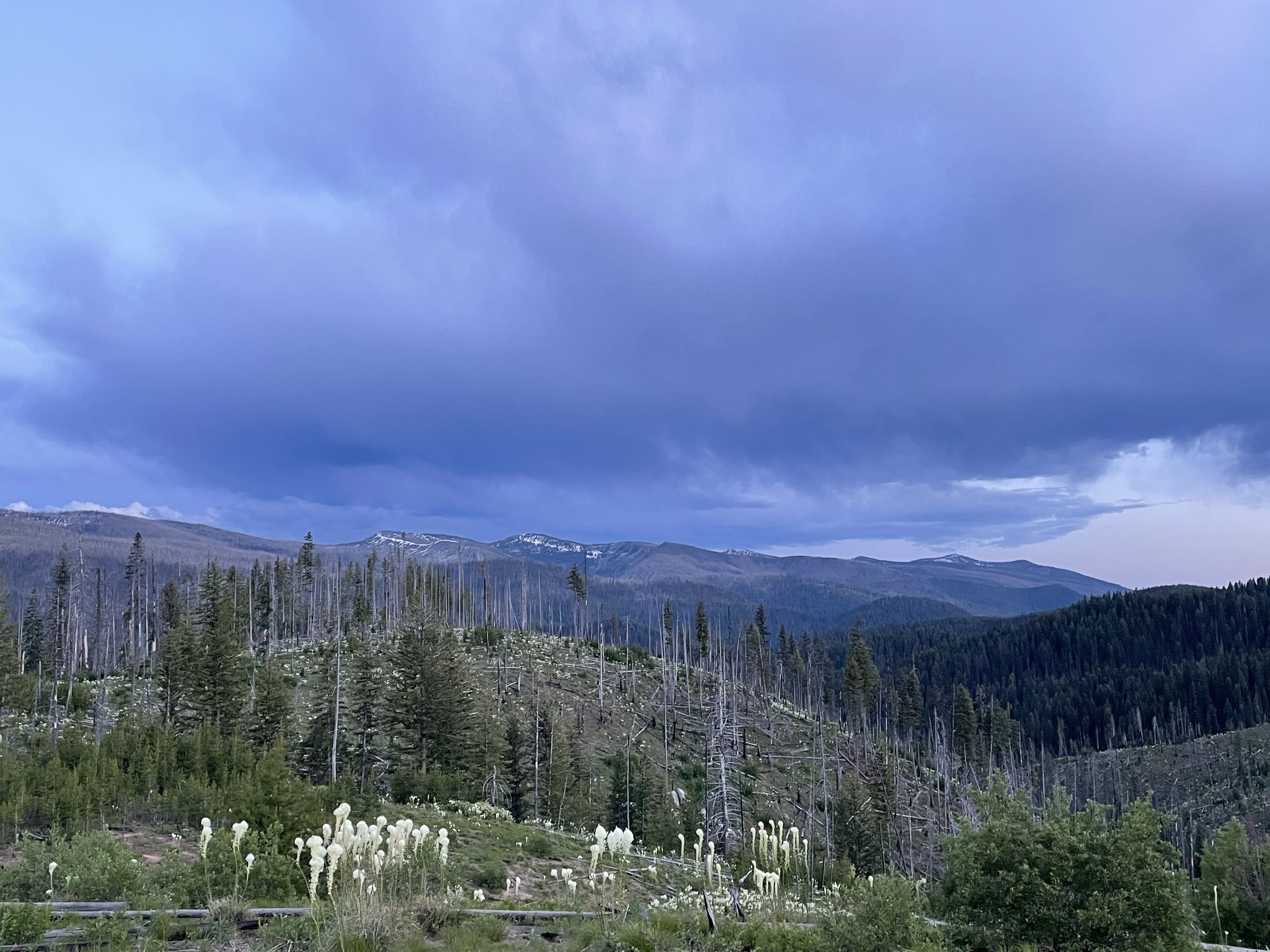
The town of Stanley is a magical vortex that has sucked me each time I have visited that town. Stanley is a wonderful spot to chill before embarking into the Frank Church and Selway-Bitterroot Wildernesses, which can span a detached and isolated time from civilization from 10-14 days. I am in love with the Frank Complex. No other place in the Lower 48 has enchanted me so other than the Gila Complex. The Frank Complex is wild, I mean fucking wild. The land feels endless with even more endless ribbons of the Salmon River river system. Canyons run as deep as 7,000ft from rivers to divides. Trails are either well-trampled or horrendously overgrown, littered with timbered downfall, or completely gone. Wildlife is wild, the bears ornery, the wolves eerily present yet quiet, the moose huge, the mountain goat suspicious, the raptors everlastingly soaring, and the rattlesnakes banded like outlaws. The Selway-Bitterroot feels even more remote, as if you are in the center of the wilderness universe. Most of the times the trail conditions are shitty, despite upkeep by wilderness immersion trail crews. The forest becomes more of rain forest the further north you get and your body temperature begins to go off the scale on both extremes as you are scorched by the sun or sodden by the overgrown foliage. As much as the Frank Church has burned the Selway-Bitterroot has too, yet the undergrowth is way more hairier with thicker undergrowth.

The clear highlights to me span from the Sawtooths to Interstate 90 at Mullan. That vast tract of wilderness is beyond description and my time in that remote are being utterly isolated is something I will continue to dream about. I will cherish my time there. North of I90 the ICT gave me some mixed feelings. I found the Pend Oreille Crest pretty cool despite the road walking leading into it and out of it. I enjoyed the crossing of the Selkirks even though the route through was too short. I thought the final 8 miles of the ICT along the giant cedar groves of the Upper Priest River was sublime. Giant ferns lined a maintained spongy trail that bumped with each step. At the Upper Priest Falls, I camped at the area submerged in the raucous cacophony of plunging water. That noisy immersion alone solidified my emotions of my isolated time on the ICT -- I loved this trail.
Overall Difficulty:
The ICT is difficult. Is it the toughest? No, not even close. The Desert Trail and the Great Basin Trail make this route look very doable. However, the ICT is tougher than all other routes between 500-1500 miles in the U.S. with the addition of the Great Divide Trail -- say for example the GDT, the GET, and the Hayduke. Additionally and condition-wise, the GDT can be compared in difficulty to the ICT depending on the time of year and the weather. As mentioned above in the General Overview blurb, the ICT is similar to what the CDT was some 10-15 years ago. On the ICT, signage can be confusing and only common in the furthest stretches south, resupply stretches are very long, the trail conditions vary drastically from easy to where-the-fuck-is-trail, a slower pace expected, map sets are hard to find including non-thru-hiker created maps like the USFS maps of the Frank Church (even those do not highlight the ICT), and has very, very long stretches of isolation where you may not see another long-distance hiker let alone just a human.

But, the ICT has improved since '15. This time around in '22, despite the extremely high snow levels and water crossings in the Sawtooths, the Frank Church had glorious trail conditions. Trail conditions changed for the worse through the Selway-Bitterroot only to revert back to glorious the rest of the way of trail. If you have done the CDT, you can do the ICT. What has changed in the recent years is that the comparable trails listed -- CDT, GDT, Hayduke, with the exception of the GET -- have been tracked on Guthook (CDT & GDT) or has been tracked by another app and shared (HT). That definitely diminishes the skill level required to hike those trails. Like the ICT, the GET has not been uploaded and tracked by the Guthook app, which means you need to truly know what you are doing. In '13 when I hiked both the Hayduke and the GET as part of my Vagabond Loop, the Hayduke was way harder than the GET. Since the app plotting and sharing of the Hayduke, the Hayduke is more accessible and not in the same nature of what the challenge used to be. One is now more or less following a defined corridor on the Hayduke. The GET, on the other hand, has remained challenging and even more so has gotten more difficult due to the necessity to read a map, the lack of maintained trails, and access issues in certain areas. Hence, the Hayduke has become way easier than the GET now.
The ICT will probably get tracked and uploaded up to Guthook at some point soon, too. So....get out and hike the ICT before you lose a really true wilderness and challenging experience!
Timing and Direction:
Research your timing wisely. This will require objectively assessing your skill level. If you go to early, you will see high snow levels and treacherous water crossings. If you go to late, your progress could stop with wildfires. If you go too early, you will be in areas before the trail crews can access the wilderness and may encounter horrible trail conditions with thousands upon thousands of downed trees from the Winter. Temperatures are hard to time with the Bruneau Desert and the Sawtooths. You will most likely be uncomfortable. Again, assess your skill level realistically and pick your poison.
I think NOBO gives one a better and more attainable chance at giving a complete and successful thru-hike. With a SOBO attempt starting traditionally later than a NOBO attempt, I think one's chance of encountering wildfire closures is exceedingly greater. For NOBO's I think somewhere around 6/7-6/21 is feasible. For SOBO's, I think somewhere around 7/1-7/14 is feasible. Granted, these suggestions are my opinion and give a window for skill level and these windows may change depending on the year. Please, take the time to really consider your start date.

Trail Conditions:
I would not rely on Facebook groups or past hikers solely for this one. Trail conditions change so much on the ICT from year to year and season to season. I, personally, do not ascribe to what others who have not been out there recently are saying anyways. I am aware of my skill level and prefer to see things for myself. The only thing I would concern myself with is to what route or trail past or current hikers have used in very specific areas, like the Frank Complex. Some trails, or red line, of the old ICT route intention have been obliterated or re-routed, are in terrible condition, or are non-existent. This holds very true from Moose Creek Ranger Station to Wilderness Gateway. In these instances, I contacted former hikers I trusted, utilized USFS Trail Conditions Report, and spoke with the Moose Creek trail crews and ranger.
I also tracked snow levels that gave me an idea of what to expect. You can contact land agencies and districts, from the USFS to the BLM, for current and updated trail conditions. Also, I found locals to give excellent advice, ones who utilize the backcountry.

I utilized the Snotel site for the Sawtooths. This site helped me assess snow levels for travel over the passes and the water equivalent of that snow depth to understand the potential for high and treacherous water crossings. I also monitored the Sawtooth SnowCam in Stanley for a frame of reference of snowmelt.
Then, for the Frank Church Selway-Bitterroot Complex I found the USFS Trail Conditions Report very helpful. This gives the reports of the separate districts with updates and details of trail maintenance, the date, and trail names and numbers. The Stanley Ranger Station has some valuable information, as well as the Frank Church USFS large scale maps. Lastly, the backcountry Ranger Stations have valuable and current information from in-the-field rangers
Dig around these sites for current information. I found them so valuable before and during a hike.
All this being said -- none of the conditions are guaranteed! One should have the mindset that conditions WILL change.
Resupply:
Very long resupply stretches exist on the ICT. Really, your main concern is from Stanley to Interstate 90 at Mullan. For the backcountry of the Frank Complex, you can try and utilize the backcountry Ranger Stations the ICT crosses -- Indian Creek, Chamberlain, and Moose Creek. The rangers super helpful. These Ranger Stations have an active airfield and you can call the district the station is in and arrange a box to be flown in via a chartered air service. This will cost money. And, you will have to do your own research.
Some of the historic ranches along the Main Fork of the Salmon River are no longer accepting and holding packages. In some case, ranches that held onto hikers' packages in the past ended up being stuck with them. This is a huge burden of responsibility put on these ranches. It is pain in the neck to get rid some of these packages. These ranches are settled in some of the wildest and largest tract of wilderness in North America. Please, consider how much these folks are helping you before shipping out a package to some extreme rural area.
One last thing on ICT resupply -- while granted the ICT is growing in hiker numbers, some of these communities are still not as familiar with thru-hikers as other long distance trails may be. This includes Post Offices that may have new employees, resorts or ranches that have new ownership or caretakers, or hotels that reside in a community that does not have postal delivery.
You have to really think in preparation for resupply on this trail!
Resources:
There seems to be a few options. I will only give this advice: Do not take the easy way out on this particular trail and just purchase a resource set if you find one. You will get into trouble just blindly following a red line on a GPS or app.
Please, do your homework on this one and plan the route as if you were building the route. It's 900m long, so it shouldn't take as long as something that may take 4 months to hike. The remoteness of the ICT requires it, I believe. Get to know the place!
Maps and Navigation:
Along with whatever ICT map set you use, utilize a GPS device or app in conjunction with the map set. The maps suggested below really give you insight to the scope of vastness of the wilderness you are walking through. This provides the user with bailout and alternate route options in case of flooding and wildfire whether spontaneous events or closures. The maps also highlight trail and corridor priority for trail maintenance.
The Frank Church River of No Return Wilderness Maps, 2 separate maps of north and south halves, published by the USFS:

The Selway-Bitterroot Wilderness Maps, 2 separate maps of both north and south halves, published by the Selway Bitterroot Frank Church Foundation:

Gear:
I packed my gear like I was packing for the CDT. Temperatures will be generally colder, but the temperatures vary so much depending on where you are at and at what time of the season you are in. For the overall temperature extremes of Idaho, the drastic change in terrain, the wetness of feet from the constant creek crossings and soggy meadows, and the humidity I brought along 2 crucial and extra items: a silk liner and an extra pair of socks (3 in total). The silk liner provided me with warmth in the chilly Sawtooths and river canyons, general overall comfort when I was sticky with sweat from the humidity, and, lastly, a light throw over when the temps were too hot to get into my quilt. I found the silk liner so damn useful. I have long since ditched a bivy, mainly due to the omnipresence of condensation and the inability to provide sufficient warmth when the temps dipped. I found the silk liner to be the flexibility and utility one typically thinks a bivy would provide.
Bug spray and a bug net for your shelter or an enclosed shelter are a must for mosquitoes. Ticks can be a pain in some areas. A reliable rain coat is necessary for the roving thunderstorms in the summer, as well as the potential for snow. Please, consider at least one trekking for the creek crossings, which can be fierce to say the least. With the concern for the huge Sawtooth to Interstate 90 stretch, take an extra battery capable of at least 2 charges. Lastly, bring a beacon for that stretch, too. That long stretch one may not have cell service for at least 2 weeks, depending on resupply.

As far as I am aware, the Hayduke is not available on Guthooks, did I miss something? Thanks for the great article and comparison to other trails!
ReplyDeleteNo, you are correct. My mistake. I know hikers are using a shared app and track for the Hayduke, I'm not sure which one tho. Thanks for the reminder! I went in an updated it. Much appreciated!
Delete