From Sangre de Cristos:
Dates: 7/2-a.m. 7/6
Section Mileage: 124m
VL Mileage: 1617m
The mountain town of Red River confused me. I felt out of place, lost. Tourists looked at me with disgusted looks, a much different friendly greeting than just a ridge over where Indios and Mexican treated me friendlier. At the P.O. I found out my food package, which contained maps as well, did not get sent. Ironically, in isolated areas, far away from people I felt aware and 'at home,' not lost, finding my way through land undefined by man. But here I was in a small mountain town out of place, feeling un-welcomed, with no maps for my next section, lost, where it should have been easy to be comfortable in its structured surroundings in the confines of man. I walked quickly around town looking for area maps specific to my section I was to hike. There was none. Red River is geared for the tourist who doesn't leave the car or if they do they fall into some type of amusement park.
Maybe I am too wild, too savage...
I was disturbed. People blatantly disregarded 'going farther.' Perplexed at this demeanor of ease, I worked at trying to find my way. All day I tried to piece it together using resources and such. In the end Brett Tucker came through via email with Northern New Mexico Loop Section maps. After printing them off I found an expensive room at a cheap motel.
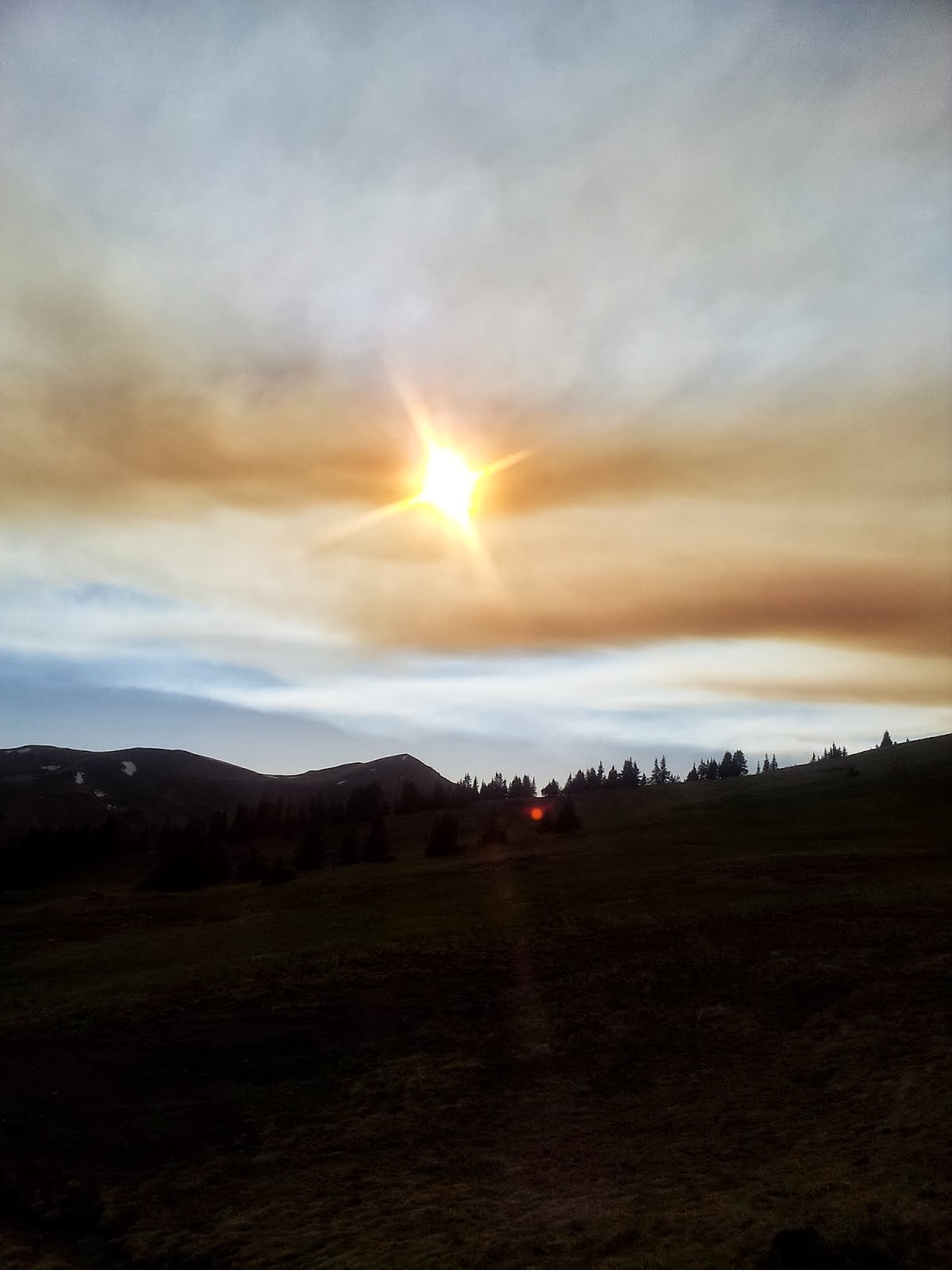
Early the next morning, dark clouds came. Rain sprinkled. And I decided to forego Wheeler Peak and its above timberline hiking to lessen my exposure to thunderous storms and lightning. Up the East Fork Red River trail, then crossed over into the Sawmill Creek drainage, and I was on the crest at a saddled addled with a large sloping meadow. An Taos Indian Reservation sign forbid me from going any farther. I went on in anyways through barbed fence line.
I traveled furtively through aging logging roads, swiftly moving along the contours of the crest. I had heard some horror stories about the Taos, how if they found you on their land they would put you on the ground with guns drawn to your head questioning you. I heeded the warnings by moving through their land leaving no trace of my existence. I made the illegal 14m walk in under 5 hours.


I was in land unfamiliar to me, very much so. I followed the maps closely but felt in the true splendor of methodically wandering, point in mind, driven. Soggy trail meandered along a low divide. Elk skittered in small herds through the forests. The afternoon brought the typical thunderstorms. However, by now I had begun to figure out the rhythm and trend of bombardment of the violent storms. Unlike most high country thunderheads, which usually move west to east in the Sierras and most of the Rockies, these storms were coming in from the north and moving south, which only made them linger more in the high country of the Sangres.
I huddled under a few large spruce while the drops became bigger. Within minutes hail fell sporadically. Then white, solid marbles pummeled the land around me. I slunk further under the spruce canopy near the base. It didn't matter; the hail persisted in violence. Aspen leaves waved side to side in the air from being flicked off sprigs and branches. The green, translucent leaves were pockmarked from the hail. The hail filled the ruts in the road. The temperature turned to a burly cold, when only an hour ago I sweated in 85 degree weather.
I left the safety of the tree, for I was too cold. I shivered, then hyped myself up to run. I scrambled down the road in 1 1/2 inches of hail on the ground. All that fell in 15 minutes. Immediately, I recognized my fleeing of the tree as a stupid idea. I found another large tree and waited out the storm for 45 minutes more.
Later, I went up Cerro Vista. At the apex, some 11,000ft, the skies opened up in another fury. Only a mile or so from the road I came from, I dashed down the mountain, descending wildly. Again, I picked my feet up into a trot and ran to lower elevations. A few miles later, the storm stopped. Cold and wet, I hiked down the trail somewhat despondent. A trucked pulled up side of me. A Mexican family from Santa Fe made a curious and friendly conversation. They offered me a beer, food, and a campsite. I politely refused, with my re-supply being so close for the next morning. Once again, only a few ridge lines from each other, the people changed. And I realized the most friendly people were the less affluent, the working class.
Sipapu Ski and Summer Resort had my package and maps for the next section. Earlier in January, I understood that I would be potentially trespassing into private property. What I didn't foresee would be that I would have to cross into Forest Service land, public land, illegally. The Jarosa and Tres Lagunas fires had closed the whole Santa Fe NF and Pecos Wilderness. I could either skip the section completely, road walk around, or go through. With the fires diminishing recently due to the wet monsoons and lower temperatures, plus with the forest being so expansive, I believed I could go through undetected but most importantly safe.


I stealthily hiked up into the Pecos. I even went cross country to avoid popular trailheads, for at these trailheads I saw yellow warning flagging signifying NO ENTRY! But as I scaled up the hills towards the 12,000ft Santa Barbara Divide I became more exposed, to the environment and to aircraft. My plan was to wait for a window towards the late afternoon, hit the Skyline Trail and head on the eastern portion of the divide of the Pecos Basin. I could not take the Skyline Trail westward towards and eventually into Santa Fe. Too much fire personnel was there and from my perch that I stood on the Divide I could see small billows of smoke from the Jarosa Fire. My clear line of safety and undetectablility was towards the east.


Maybe I am too wild, too savage...
I was disturbed. People blatantly disregarded 'going farther.' Perplexed at this demeanor of ease, I worked at trying to find my way. All day I tried to piece it together using resources and such. In the end Brett Tucker came through via email with Northern New Mexico Loop Section maps. After printing them off I found an expensive room at a cheap motel.
Early the next morning, dark clouds came. Rain sprinkled. And I decided to forego Wheeler Peak and its above timberline hiking to lessen my exposure to thunderous storms and lightning. Up the East Fork Red River trail, then crossed over into the Sawmill Creek drainage, and I was on the crest at a saddled addled with a large sloping meadow. An Taos Indian Reservation sign forbid me from going any farther. I went on in anyways through barbed fence line.
I traveled furtively through aging logging roads, swiftly moving along the contours of the crest. I had heard some horror stories about the Taos, how if they found you on their land they would put you on the ground with guns drawn to your head questioning you. I heeded the warnings by moving through their land leaving no trace of my existence. I made the illegal 14m walk in under 5 hours.


I was in land unfamiliar to me, very much so. I followed the maps closely but felt in the true splendor of methodically wandering, point in mind, driven. Soggy trail meandered along a low divide. Elk skittered in small herds through the forests. The afternoon brought the typical thunderstorms. However, by now I had begun to figure out the rhythm and trend of bombardment of the violent storms. Unlike most high country thunderheads, which usually move west to east in the Sierras and most of the Rockies, these storms were coming in from the north and moving south, which only made them linger more in the high country of the Sangres.
I huddled under a few large spruce while the drops became bigger. Within minutes hail fell sporadically. Then white, solid marbles pummeled the land around me. I slunk further under the spruce canopy near the base. It didn't matter; the hail persisted in violence. Aspen leaves waved side to side in the air from being flicked off sprigs and branches. The green, translucent leaves were pockmarked from the hail. The hail filled the ruts in the road. The temperature turned to a burly cold, when only an hour ago I sweated in 85 degree weather.
I left the safety of the tree, for I was too cold. I shivered, then hyped myself up to run. I scrambled down the road in 1 1/2 inches of hail on the ground. All that fell in 15 minutes. Immediately, I recognized my fleeing of the tree as a stupid idea. I found another large tree and waited out the storm for 45 minutes more.
Later, I went up Cerro Vista. At the apex, some 11,000ft, the skies opened up in another fury. Only a mile or so from the road I came from, I dashed down the mountain, descending wildly. Again, I picked my feet up into a trot and ran to lower elevations. A few miles later, the storm stopped. Cold and wet, I hiked down the trail somewhat despondent. A trucked pulled up side of me. A Mexican family from Santa Fe made a curious and friendly conversation. They offered me a beer, food, and a campsite. I politely refused, with my re-supply being so close for the next morning. Once again, only a few ridge lines from each other, the people changed. And I realized the most friendly people were the less affluent, the working class.
Sipapu Ski and Summer Resort had my package and maps for the next section. Earlier in January, I understood that I would be potentially trespassing into private property. What I didn't foresee would be that I would have to cross into Forest Service land, public land, illegally. The Jarosa and Tres Lagunas fires had closed the whole Santa Fe NF and Pecos Wilderness. I could either skip the section completely, road walk around, or go through. With the fires diminishing recently due to the wet monsoons and lower temperatures, plus with the forest being so expansive, I believed I could go through undetected but most importantly safe.


I stealthily hiked up into the Pecos. I even went cross country to avoid popular trailheads, for at these trailheads I saw yellow warning flagging signifying NO ENTRY! But as I scaled up the hills towards the 12,000ft Santa Barbara Divide I became more exposed, to the environment and to aircraft. My plan was to wait for a window towards the late afternoon, hit the Skyline Trail and head on the eastern portion of the divide of the Pecos Basin. I could not take the Skyline Trail westward towards and eventually into Santa Fe. Too much fire personnel was there and from my perch that I stood on the Divide I could see small billows of smoke from the Jarosa Fire. My clear line of safety and undetectablility was towards the east.
Again, I moved swiftly through land illegally. Nevertheless, I slowed at moments, even stopped, when I would get the attention of multiple herds of elk. Throughout my time on the Santa Barbara Divide I observed some 500 elk, grazing and lulling around on the alpine grasses. Thunderheads horseshoed around me and left me with a window. I had startling views of tumultuous cumulonimbus clouds towering over the eastern and Western horizons. Purple electric lightning strikes glittered in the sky, thunderous booms mechanically churned in the basin all around me. I jumped when the claps and peals were quick and simultaneous. I camped in the a small, dense forest on Cebolla Mountain. The wind howled and, at one point, blew a tent stake out of the ground. My tarp whipped and flapped. A long night persisted, the thunder and flashes of lightning making it hard for me to sleep. I wanted the night to end.
I was getting tired. My legs cramped and stiffened. With water non-existent, I slurped up rainwater from small pools on porous rocks in the grass. The day slowed to a crawl. I transected old burn areas littered with fallen trees, excruciatingly hard work. I toiled overly hard and all I could think of was the small town of Pecos. After 32 miles or so, I ended my day on a closed forest road. This night a light breeze whittled though giant ponderosas lulling me to sleep. I dreamt of a tired black wolf, alone and achy, hungry and desperate. The wind breathed to spark my fire.
I made Pecos the next morning. Again, undetected and safe. And free, the vagabond in me felt free.